Daily Current Affairs for UPSC
Bomb Cyclone

Topic- Environment and Ecology [GS Paper-3]
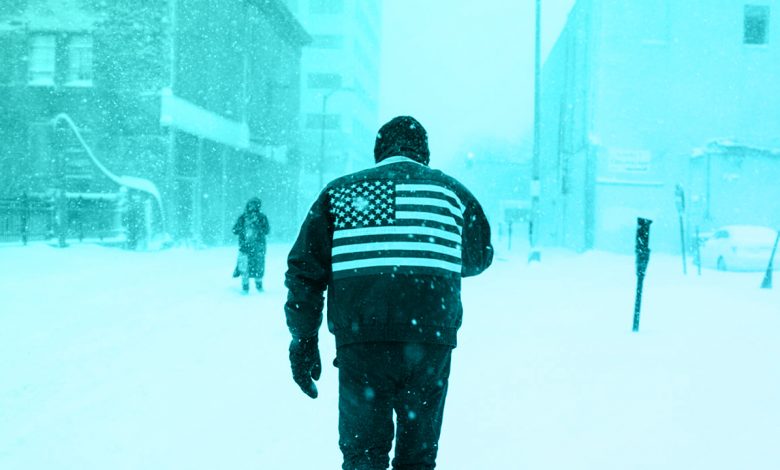
Context- Recently, an intense blizzard or snowstorm is wreaking havoc across the United States and Canada and the forecasters have termed the blizzard as different from the usual weather events and called it a “bomb cyclone.”
Key Highlights
-
- Location:
- The scope of the storm has been “unprecedented”, stretching from the Great Lakes near Canada to the Rio Grande along the border with Mexico.
- Location:
- Situation led by the blizzard/ bomb cyclone:
-
- Around 60% of the US population faced some sort of winter weather advisory or warning, and temperatures plummeted drastically below normal in major areas of the country.
- Over 30 people confirmed dead so far in the US, and four people dead in Canada after a road accident on an icy path.
Bomb Cyclone
-
- Formation:
- Storms can be formed when a mass of low-pressure air meets a high-pressure mass. Further the air flows from high pressure to low, creating winds.
- The recent bomb cyclone in the US happened when warm air from the gulf of Mexico collided with the cold arctic air.
- What defines a bomb cyclone is how rapidly the pressure drops in the low-pressure mass by at least 24 millibars in 24 hours.
- It quickly increases the pressure difference, or gradient, between the two air masses, making the winds stronger.
- This process of rapid intensification has a name i.e. bombogenesis.
- Formation:
- Direction & continuation of the current cyclone:
-
- When the winds blow, the rotation of the Earth creates a cyclonic effect.
- The direction is counterclockwise in the Northern Hemisphere (when viewed from above).
- As the area where the two air masses meet moves northward and eastward, proper conditions for bombogenesis should continue moving as well.
Outcomes of the Cyclone:
- When this kind of storm is not exceedingly rare, this one is very strong, with high winds that are bringing heavy snow or rain to many areas.
- Air pressure dropped to at least 962 millibars, while elsewhere it was as high as 1,047 millibars Ans it is a really sharp gradient.
- This has also led to the development of extreme storm conditions near the core of the low-pressure system, with particularly harsh conditions.
Predictions of dissipation:
- Forecasts have called for above-average temperatures across most of the country.
- But as the Arctic air spreads over most of the country it will eventually warm, reducing the pressure variations and the storm will dissipate.
Precautions:
- The US National Weather Service has warned people against travelling.
- It stated such cold conditions can easily cause frostbite, and in cases of longer exposure, hypothermia and death.
- Those who will be travelling by road will need to exercise particular caution, as such visibility will be affected.
- Those indoors have been told to maintain safety precautions, such as charging electronic devices and keeping torches ready.
- Apart from wearing the appropriate layers of clothing, it was advised that those working outside keep taking breaks to avoid exertion or health issues.
May become frequent phenomenon:
- Climate campaigners raise concerns as global warming is likely to make bomb cyclones more frequent and intense.
What is a Cyclone?
-
- A cyclone is any low-pressure area with winds spiralling inwards and it is caused by atmospheric disturbances around a low-pressure area
- It is distinguished by swift and destructive air circulation.
- Pattern of circulation:
-
-
- The air circulates inward in an anticlockwise direction in the Northern hemisphere and clockwise in the Southern hemisphere.
- Formation of Cyclones:
- Before cloud formation, water takes up heat from the atmosphere in order to change into vapour. When water vapour changes back to liquid form as raindrops and this heat is released to the atmosphere.
- The heat released to the atmosphere warms the surrounding air. The air tends to rise and it causes a drop in pressure. More air rushes to the centre of the storm and thus this cycle is repeated.
- The chain of such events ends with the formation of a very low-pressure system with very high-speed winds revolving around it. It is this weather condition which is called a cyclone.
- Intensity & strength of cyclone:
- The amount of pressure drop in the center and the rate at which it grows outwards gives the intensity of the cyclones and the strength of winds.
- Eye:
- The centre of a cyclone is a calm area and it is called the eye of the storm.
- The diameter of the eye varies from 10 to 30 km.
- Eye is a region free of clouds and has light winds.
-
- High-speed winds:
-
- Around this calm and clear eye, there is a cloud region of around 150 km in size.
- In this region there are high-speed winds of 150–250 km/h and thick clouds with heavy rain.
- Away from this region the wind speed gradually slows down.
- A large cyclone is a violently rotating mass of air in the atmosphere of 10 to 15 km high.
Types of Cyclones:
- Tropical Cyclone:
-
-
- Cyclones which develop in the regions between the Tropics of Capricorn and Cancer are called tropical cyclones.
- Tropical cyclones are large-scale weather systems developing over tropical or subtropical waters, where they are organised into surface wind circulation.
-
- Extra tropical Cyclone (Temperate Cyclone):
-
- They occur in temperate zones and high latitude regions of the world
- In contrast with tropical cyclones, extratropical cyclones produce rapid changes in temperature and dew point along broad lines, called weather fronts, about the center of the cyclone.


.png)


