Issues of Coastal Erosion in India
[GS Paper 3 - Environmental Degradation and issues arising out of it]
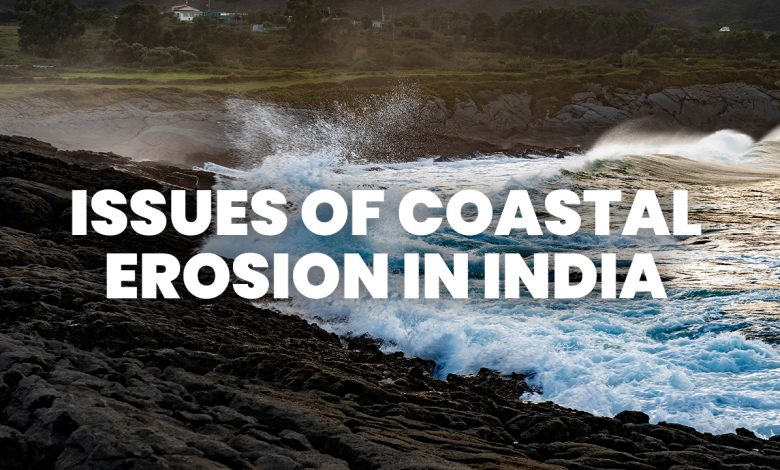
Context – The Ministry of Earth Sciences, in a response to a question, informed the Lok Sabha that of the 6,907 km long Indian coastline of the mainland, about 34% is under varying degrees of erosion.
India’s long peninsular region constantly battles erosion. The developmental activities are often carried out without a clear understanding of the coastal dynamics. This leads to a long term, in the worst cases, permanent damage particularly to the local communities.
About Coastal Erosion
- It is the process by which local sea-level rise, strong wave action, and coastal flooding wear down or carry away rocks, soils, and/or sands along the coast.
- There are four main processes of coastal erosion. These are corrosion, abrasion, hydraulic action and attrition.
- Coastal erosion structures Seawalls, revetments, bulkheads, groins and breakwaters may reduce erosion in the short term.
Current Status of Coastal Erosion in India
- 34% Of the 6907.18-km-long Indian coastline of the mainland is under wearing degrees of erosion.
- 26 % of the coastline is of an accreting nature. The remaining 40% is in a stable state.
- Observation by the National Center for Coastal Research(NCCR), Chennai says from 1990-to 2018:
- West Bengal – 60.5% of its length is eroded
- Kerala – 46.4% of the west coast is eroded
- Gujarat – 27.06% erosion
- Puducherry – 2% coastal erosion
- Tamil Nadu – 42.7% erosion
- The Indian National Center for Ocean Information Services (INCOIS), under the Ministry of Earth Sciences, has prepared and published an atlas of coastal vulnerability index maps for the entire coastline of India. The data has been scaled on a 1:100000 scale.
- It is based on the following data – Sea level rise, Coastal slope, Shoreline Change Rate, Coastal Elevation, Coastal Geomorphology, Tidal Range, Significant Wave Height.
Reasons Behind Coastal Erosion
- Wave energy is considered to be the primary reason for coastal erosion.
- Natural hazards like cyclones, thermal expansion of seawater, storm surges, tsunami etc due to the melting of continental glaciers and ice sheets as a result of climate change hamper the natural rhythm and precipitate erosion.
- Strong littoral drift resulting in sand movement can also be considered as one of the major reasons for coastal erosion.
- Dredging, sand mining and coral mining have contributed to coastal erosion causing sediment deficit, modification of water depth leading to longshore drift and altered wave refraction.
- Coastal erosion has been sparked by fishing harbors and dams constructed in the catchment area of rivers and ports reducing the flow of sediments from river estuaries.
Measures to Prevent Coastal Erosion
- Improving vegetation along the coastline, which is important for improving slope stability and providing shoreline protection.
- Using Geosynthetic tubes that are being used along the coast in Odisha.
- Building out into the sea, low walls or barriers called groynes to check drifting.
- Making use of indigenous knowledge of local communities prior to decision making with respect to developmental projects along the coastline.
Government Departments and Ministries
- The NCCR, an attached office of the Ministry of Earth Sciences, monitors shoreline changes along the Indian coast. It has carried out a national shoreline change assessment mapping for Indian coast using 28 years of satellite data from 1990 to 2018 along nine coastal states and two Union territories (UT) to provide information for coastal management strategy, the minister added.
- The National Center for Sustainable Coastal Management under the Union Ministry of Environment, Forests and Climate Change and the Central Water Commission under the Union Ministry of Jal Shakti also undertake studies on shoreline changes / coastal erosion and their impact.
- Another organization under the Ministry, the Indian National Centre for Ocean Information Services (INCOIS) has prepared and published an atlas of Coastal Vulnerability Index (CVI) maps for the entire coastline of India at a 1:100000 scale.
Way Forward
As per the suggestion of the 15th Finance Commission, the National Disaster Management Authority (NDMA) and/or the Ministry of Home Affairs have to develop suitable norms for mitigation measures to prevent erosion while both the Union and State Governments need to develop a policy to deal with the extensive displacement of people caused by coastal and river erosion.


.png)