Daily Current Affairs for UPSC
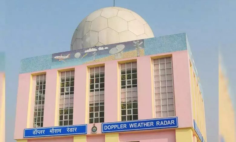
Doppler Weather Radar Network
Topic- Science and Technology [GS Paper-3]
Context- Recently the Keynote Address was delivered on the occasion of 148th Foundation Day of India Meteorological Department (IMD) in New Delhi.
Key Highlights
- The Doppler Weather Radar Network will cover the whole country by 2025 to predict extreme weather events more accurately.
- Recently, IMD has taken proactive steps in order to increase the Radar Network from mere 15 in 2013 to 37 in 2023 and will add 25 more in the next 2-3 years.
States:
- There are in total four Doppler Weather Radar Systems in Jammu and Kashmir, Uttarakhand and Himachal Pradesh.
Climate Services:
- They are very crucial for short and long term planning and strategy development
- IMD has already initiated these services in five major thrust areas such as
- Agriculture,
- Health,
- Water,
- Energy
- Disaster Risk Reduction
- It also has lined up plans to expand them through customization of products.
Doppler Weather Radar Network
- It is a specialized radar which uses the Doppler effect to produce velocity data about objects at a distance.
- It is particularly designed to improve precision in long-range weather forecasting and surveillance using a parabolic dish antenna and a foam sandwich spherical radome.
- It also has the equipment to measure rainfall intensity, wind shear and velocity and locate a storm centre and the direction of a tornado or gust front.
- It provides advanced information, enhancing the lead-time which is essential for saving lives and property, in the event of natural disaster associated with severe weather.
- Division of Doppler Radars and their applications:
- Doppler radar can be divided into many different categories according to the wavelength which are L, S, C, X, K.
- L Band Radars:
- They operate on a wavelength of 15-30 cm and a frequency of 1-2 GHz.
- They are mostly used for clear air turbulence studies.
- S-band radars:
- They operate on a wavelength of 8-15 cm and a frequency of 2-4 GHz.
- Due to the wavelength and frequency, S-band radars are not easily attenuated. This makes them useful for near and far range weather observation.
- The disadvantage to this band of radar is that it requires a large antenna dish and a large motor to power it.
- C band radars:
- These radars operate on a wavelength of 4-8 cm and a frequency of 4-8 GHz. Because of the wavelength and frequency, the dish size does not need to be very large.
- It makes C band radars affordable for TV stations.
- The signal is more easily attenuated, hence this type of radar is best used for short-range weather observation.
- X-band radars:
- They operate on a wavelength of 2.5-4 cm and a frequency of 8-12 GHz.
- Due to the smaller wavelength, the X band radar is more sensitive and can detect smaller particles.
- It is mainly used to detect thunderstorms and lightning.
- K band radars:
- They operate on a wavelength of .75-1.2 cm or 1.7-2.5 cm and a corresponding frequency of 27-40 GHz and 12-18 GHz.
- The band is split down the middle due to a strong absorption line in water vapour.
- It is similar to the X band but is just more sensitive.
Doppler effect
- The Effect refers to the change in wave frequency during the relative motion between a wave source and its observer.
- It was discovered by Christian Johann Doppler and he described it as the process of increase or decrease of starlight that depends on the relative movement of the star.
- Doppler Effect works on both light and sound objects.
Radars (Radio Detection and Ranging)
- It is a device which uses electromagnetic waves in the microwaves region to detect location (range & direction), altitude, intensity and movement of moving and non-moving objects.
- It has its own source of illumination or a transmitter for locating targets.
Significance
- The Weather prediction accuracy has seen a growth by about 20-40% for different severe weather events forecast.
- The warning and advisory services are helping farmers and fishermen in improving their economy.
- For instance, the investment in the monsoon mission programme has resulted in return of 50 rupees for investment of each one rupee.
- The farmers below the poverty line specially have benefited immensely as Agromet Advisories at District and Block Levels are used by crores of farmers during various stages of farming and the service is being expanded.
- It helps the public, disaster managers as well as stakeholders to initiate timely response action to mitigate the disasters further.
- The forecasting of monsoons that are a lifeline to our food security has resulted not only in the improvement of the economy but also reducing the loss of lives because of monsoonal floods and droughts in the south Asian region.
- Such developments have helped in minimizing loss of lives from several extreme events like cyclone, heavy rain, thunderstorm, heat wave and cold wave etc. in recent years with its precise forecasting and timely warnings.
India Meteorological Department (IMD)
- IMD was established in 1875.
- It works under the Ministry of Earth Sciences of the Government of India.
- It is the principal organ responsible for meteorological observations, weather forecasting and seismology.
- It has been continuously redefining its focus for accurate Prediction of Monsoon and cyclones as our GDP is mainly based on agriculture.
Initiatives of weather predictions
-
- Mausam App is a new mobile application called “Mausam” for the Indian Meteorological Department (IMD) which will help users track weather updates and also bring in the enhanced forecast as well as warning services from the government.
- Meghdoot App:
-
-
- The Ministries of Earth Sciences and Agriculture have launched a mobile application which will provide location, and crop and livestock-specific weather-based agro advisories to farmers in local languages
-
- Damini App:
-
- The Indian Institute of Tropical Meteorology (IITM) has launched ‘Damini’, a free mobile-based application that can warn people about lightning at least 30-45 minutes before it strikes
Way Ahead
- A National Framework must be created on priority to provide climate products and information for Sectoral applications.
- The disaster managers, general public and stakeholders under the umbrella of National Disaster Management Plans, guidelines, SOPs introduced by the present Government should be vehemently followed so as to continue the rewards being reaped.


.png)